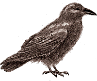
raaf

Dit is Raaf

De webpagina's van Erik Springelkamp


Raaf

Artikelen
Fotos
Files
Videos
CM
Login

Categorieën

Foto (61)
Groningen (58)
Geschiedenis (16)
Cultuur (11)
Persoonlijk (10)
Drente (7)
Wetenschap (7)
Politiek (5)
ICT (4)
Portolaan (4)
Video (4)
Rechten (2)
Wargames (1)

Archief

2024 (1)
2016 (6)
2015 (18)
2013 (5)
2010 (16)
2009 (19)
2008 (28)
 
RaafBlog
 
2007-2008
2006-2007
1997-2005

Ooievaarsnest 2015

2015-03-07 21:23
Categorieën:  Drente  Foto

Blankehoeve

2015-02-16 22:13
Categorieën:  Drente  Foto  Groningen

Hondsrug

2015-01-31 16:51

Hondsrug

An interesting thing I learned at the Day of the Archeology in April 2013 was the way our local geography was formed.

The yellow-red piece of highground in this elevation map is essentially the province of Drenthe, with the City of Groningen at the Northern tip.

The most obvious features here are the parallel ridges running from SSE to NNW on the East side of the plateau. The Easternmost being called the 'Hondsrug'.

But on the West side of the plateau a much finer grid of ridges running SSW to NNE can be recognised.
These latter ridges were formed during the Salien (238.000 - 128.000 BP) when an ice sheet scraped towards the SSW.

At the end of that ice age an enormous melting lake formed in the area of Münster in the Westphalian Lowland.

This made the ice sheet flow very fast (for an ice sheet) towards the SSE, carving the major structure into the earth. At that time there were parallel ridges for 100 km towards the East, but then the lake near Münster broke through towards the North Sea area in a giant flush, washing away anything in its path East of the last ridge on this map.

The Westphalian Lowland is surrounded by low mountain ranges in the South and East, and by the ice sheet on the West and North, so a tremendous amount of water could be locked up there.

Thus the bed of the river Ems would be formed for the future.

Directly to the East of the 'Hondsrug' ridge, a 80 metres deep valley was formed, that would become sea in the upcoming warm period, and would be filled with sand by the wind during the last ice age, when the ice didn't reach all the way here.

Categorieën:  Drente  Geschiedenis  Groningen  Wetenschap

Vennebroek 2

2010-11-07 22:57

Categorieën:  Drente  Foto  Groningen

Vries

2010-07-07 22:49

Categorieën:  Drente  Foto

Anloo

2010-06-16 13:34

Categorieën:  Drente  Foto

Zeijen

2009-06-14 19:53


Een klein hunebed, niet heel indrukwekkend, midden in het veld, zij het met wat eerbiedige bomen er omheen.

Toch laten de vergezichten zien dat het indertijd, toen de reliefverschillen groter waren door het minder hoog gegroeide veen in de laagten, een dominante plek geweest moet zijn.


Categorieën:  Drente  Foto

Top